Satellite Data Generation
- Category: AI/ ML
- Domain: Monitoring System
- Project time line: 2020 - 22
- Project URL of Till Date Projects: Project Link
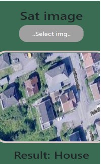
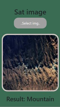
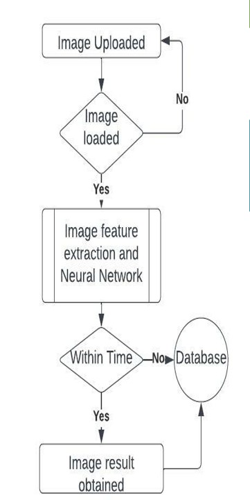
A satellite image obtained is fed into the database where the algorithm classifies each images with respect to the content. The satellite dataset generated consists of monuments, mountains, car parking, water bodies, ships and docks and grounds. This is run to test algorithm proficiency in satellite captured images. The dataset generated by the user & can be updated as number of inputs by user increases and the number of classifications of satellite images along with it. Software Implementation: